22. 12. 2006 10:30 | 01_Mobility_&_Mashup_Situations , 02_Project_Links_&_Ressources_4 , 12_Curated_posts
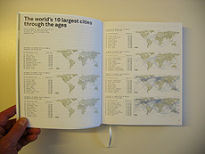
Metropolitan world atlas
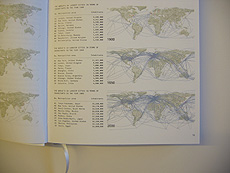
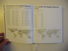
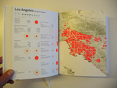
Metropolitan world atlas by 010 Publishers presents collected data about major cities on earth. All main data are displayed through graphics, so as the variation of those main cities over time, in particluar the increase of exchanges between them (communication, transportation by car, plane, boat, etc.). It is definitely a good source to speak about a global urban network and about the mobility or communication within it.
-
-
-
Posted by patrick keller at 22. 12. 2006 10:30